I’ve always been intrigued by maps; I love the fine lines, the topography, the combination of organic shapes and ordered grids. Despite all the variety, all maps have an underlying structure.
Many of my recent projects have been centered around social justice design; I wanted to explore another social justice issue for my project. I noticed lots of articles coming out about rising water levels around the globe. After becoming familiar with New York City in college, I wanted to speak to other New Yorkers. The impact of water level rise will be devastating, yet even with its very large population, so few New Yorkers are aware of this issue.
With the given information, I hope everyone who views this set of maps reflects on the beauty of the city landscape, and just how much land will become submerged. I hope the side by side comparison silhouette of New York City in 2020 compared with New York City in 2060, leaves viewers thinking just how alarming the contrast is.
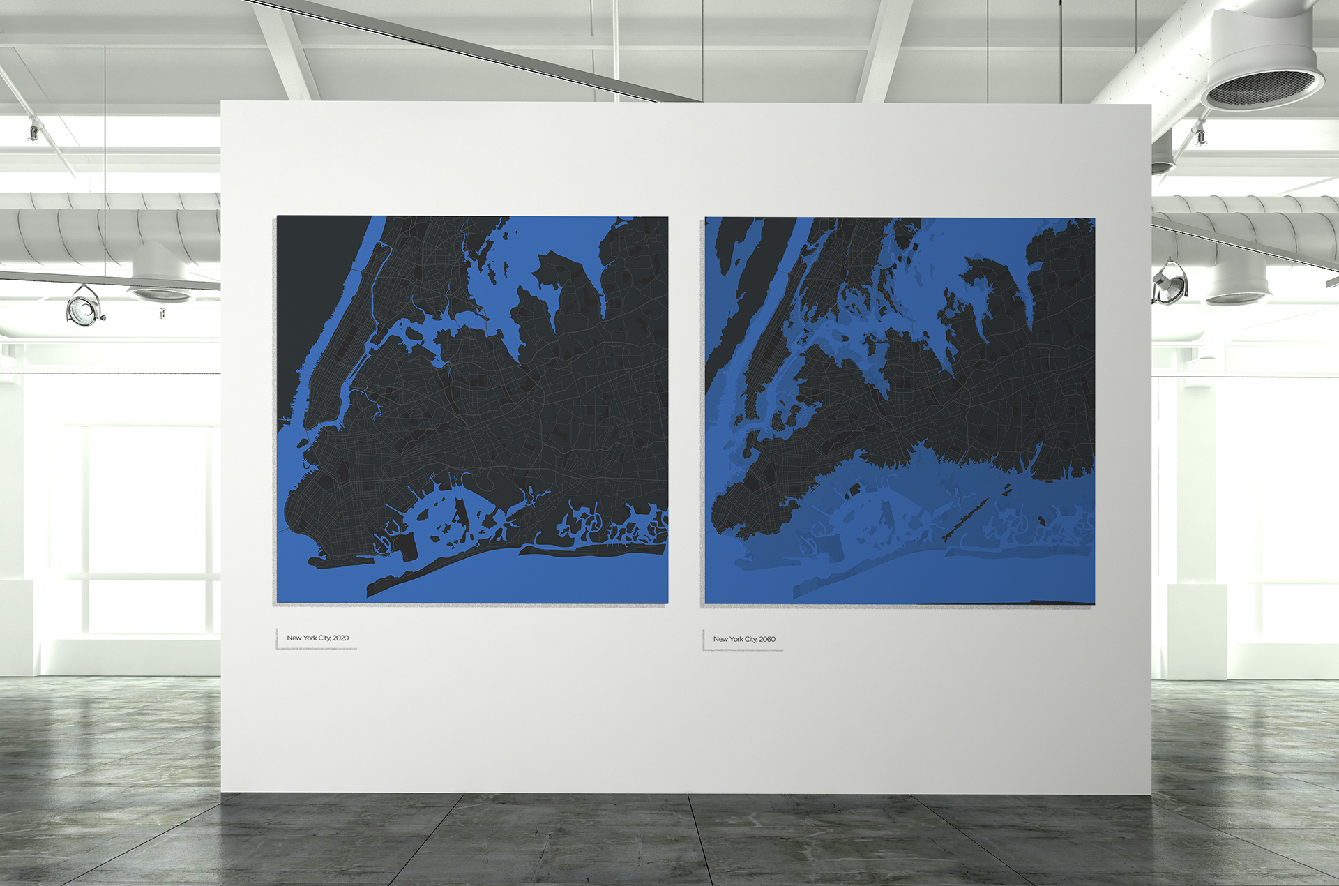
Each pair of images below shows how the city or borough looks in 2020, compared with how it will look in 2060, if water level projections continue on their current paths.
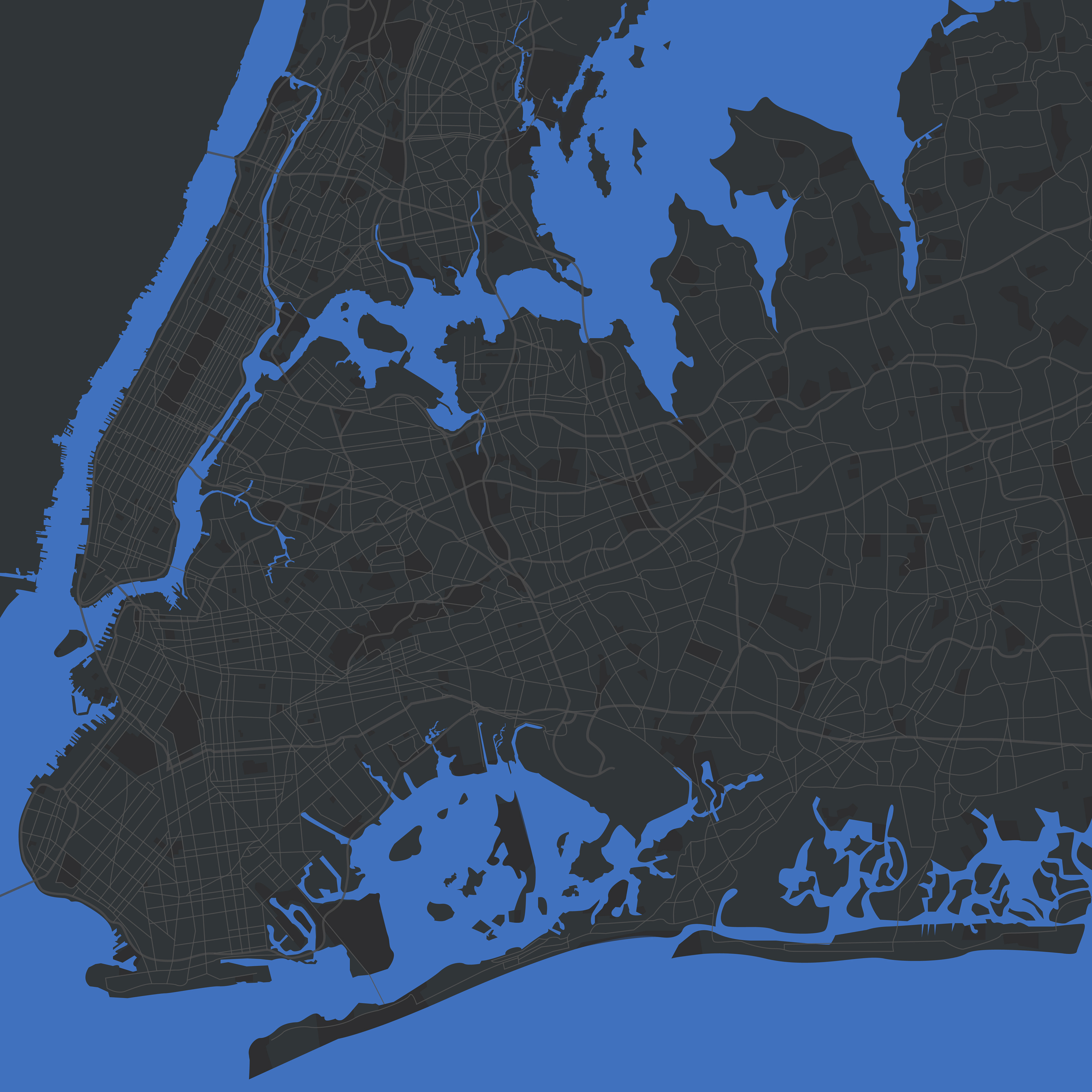
New York City, 2020
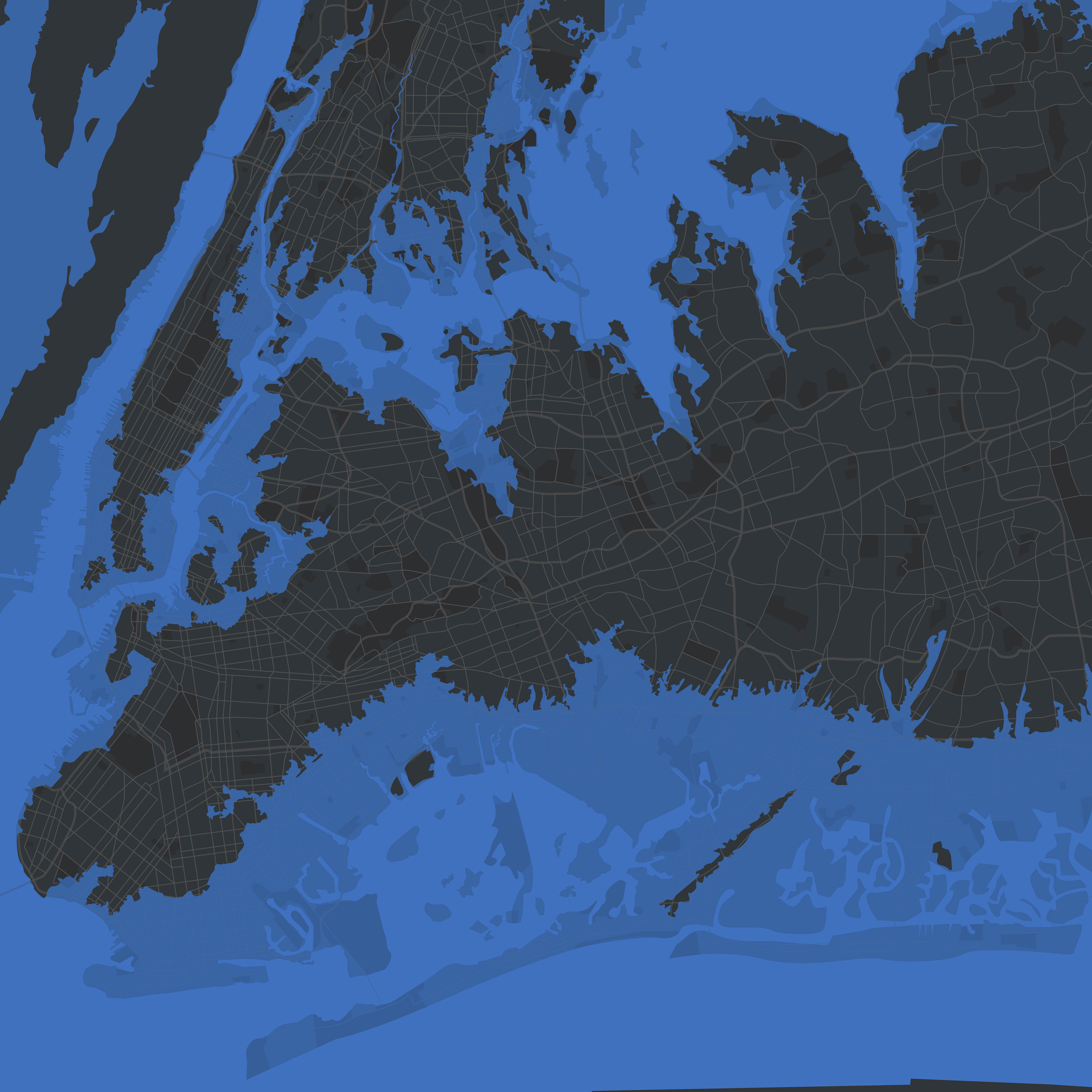
New York City, 2060
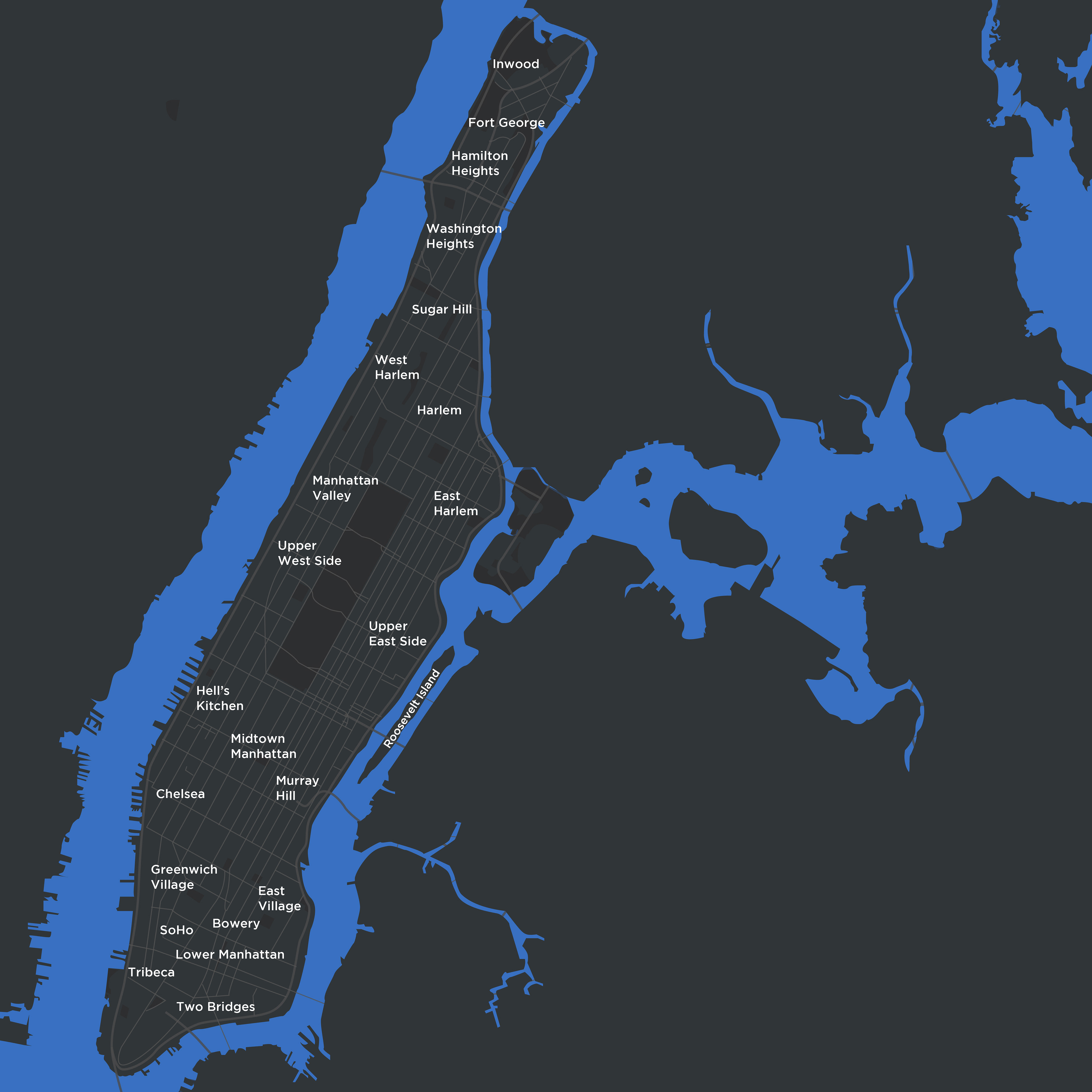
Manhattan, 2020
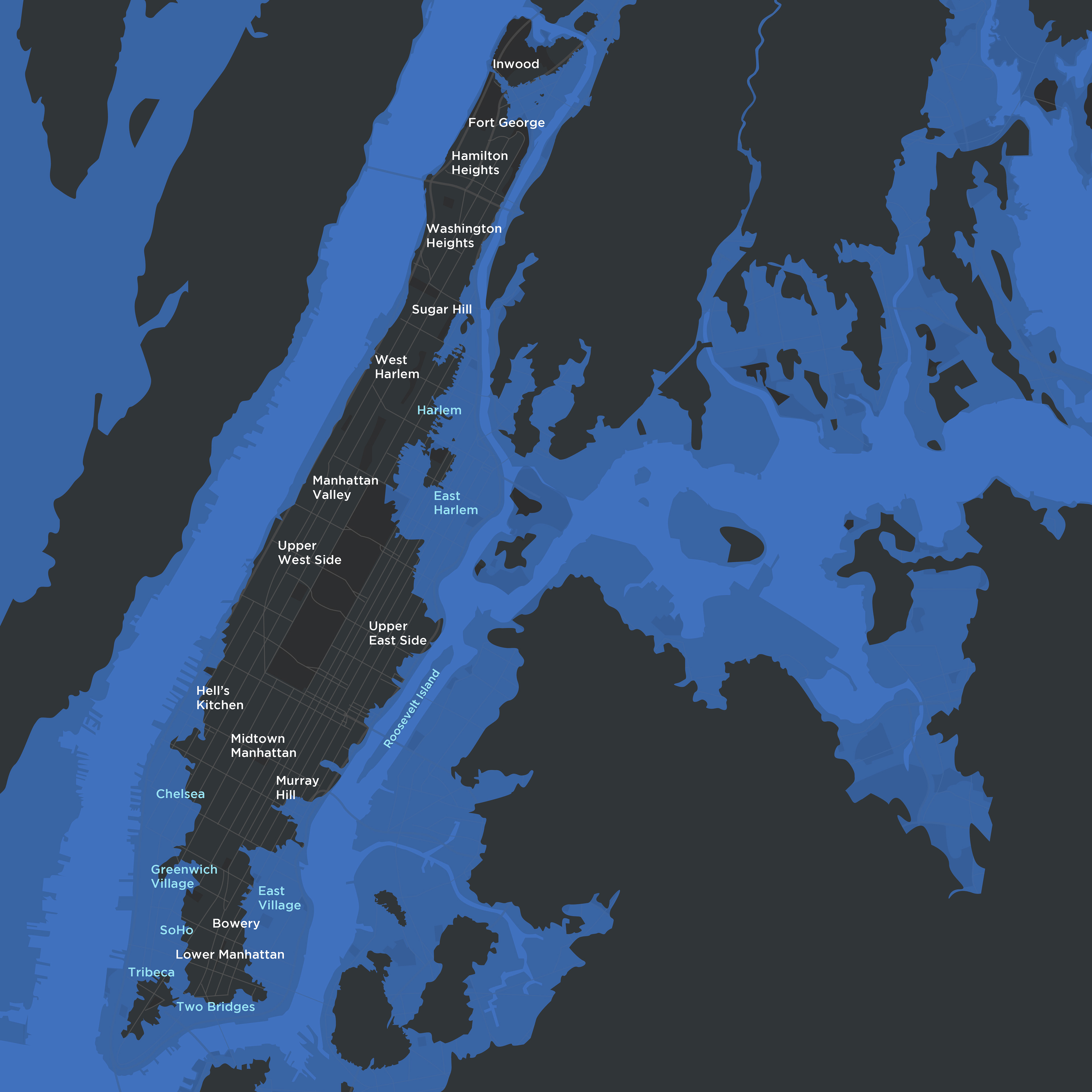
Manhattan, 2060
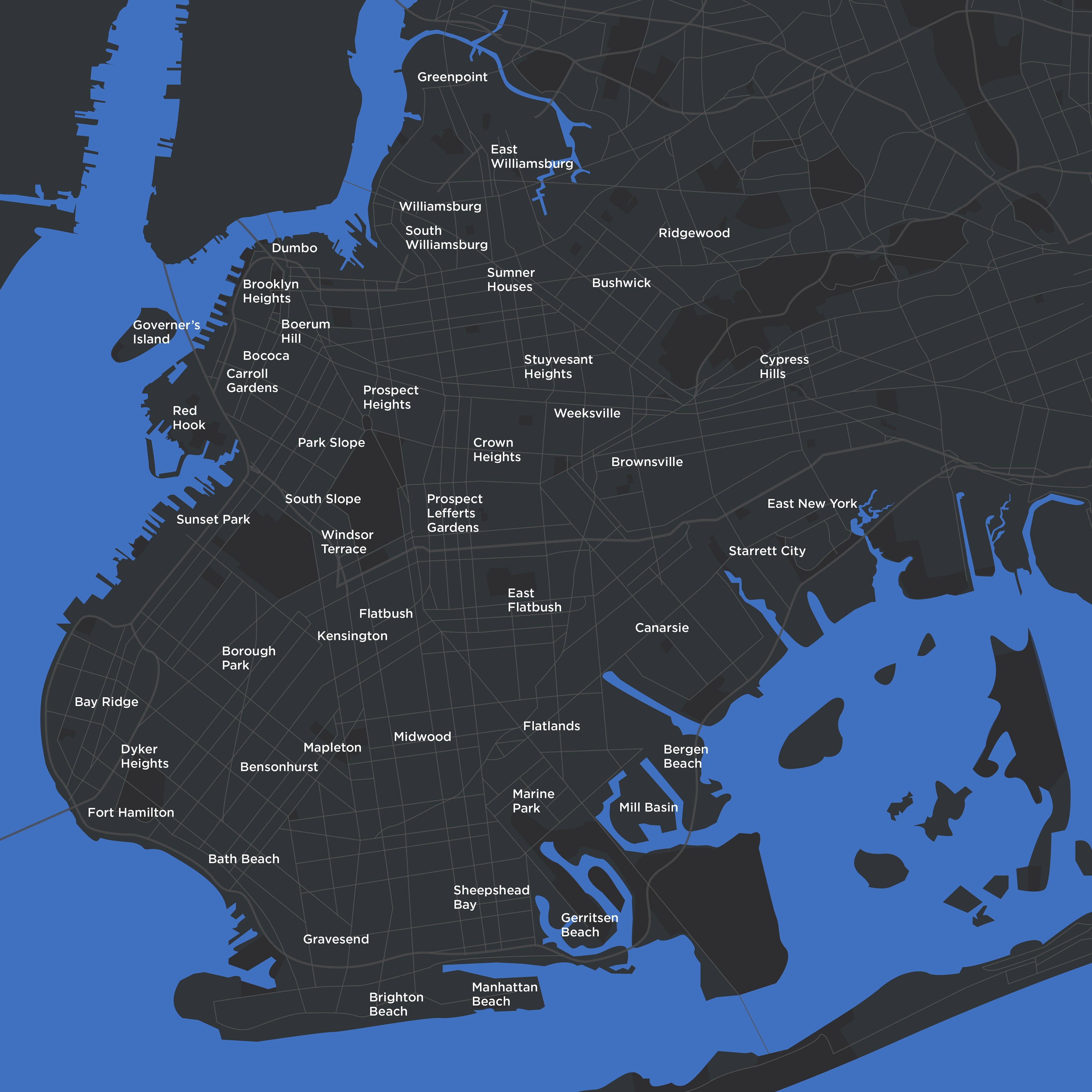
Brooklyn, 2020
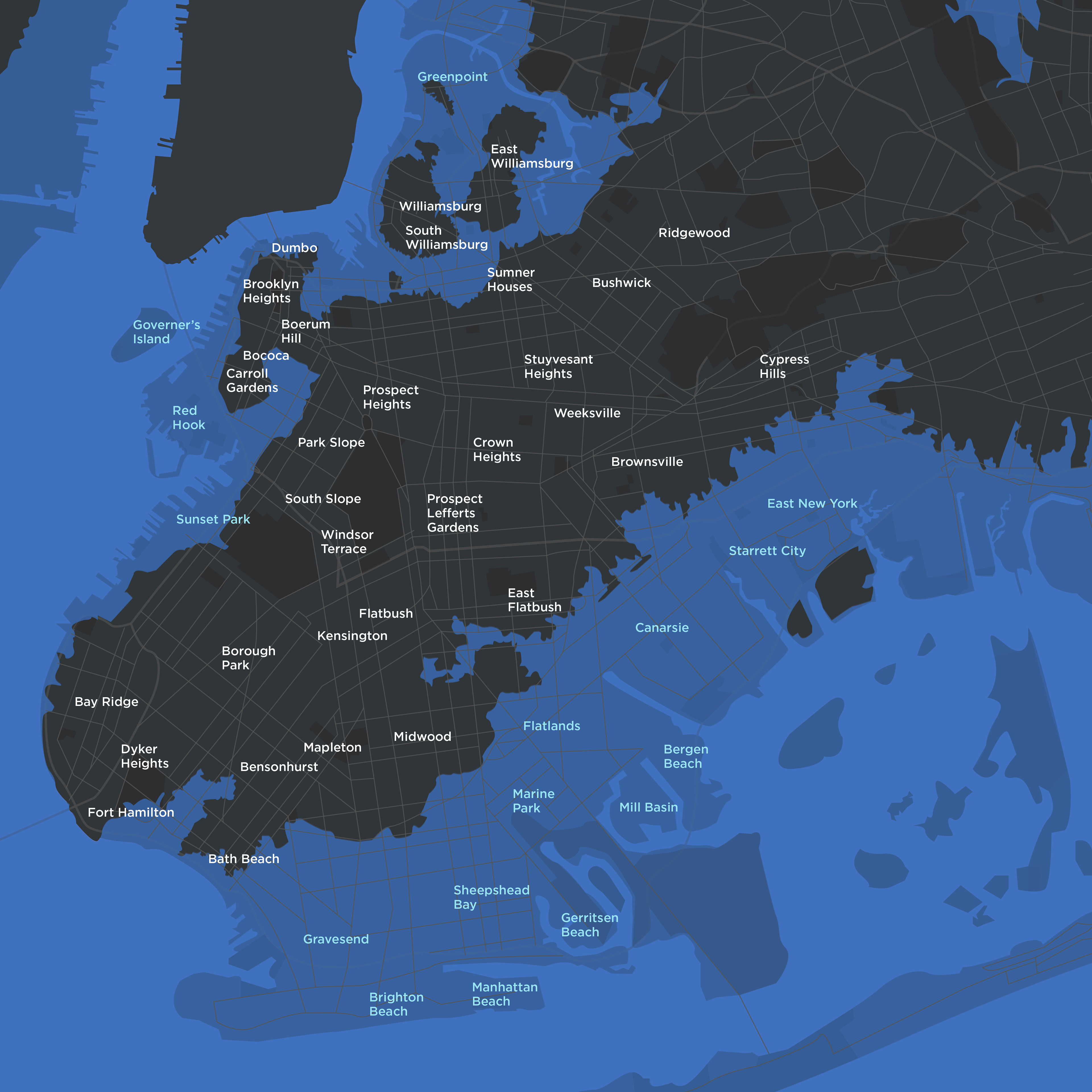
Brooklyn, 2060
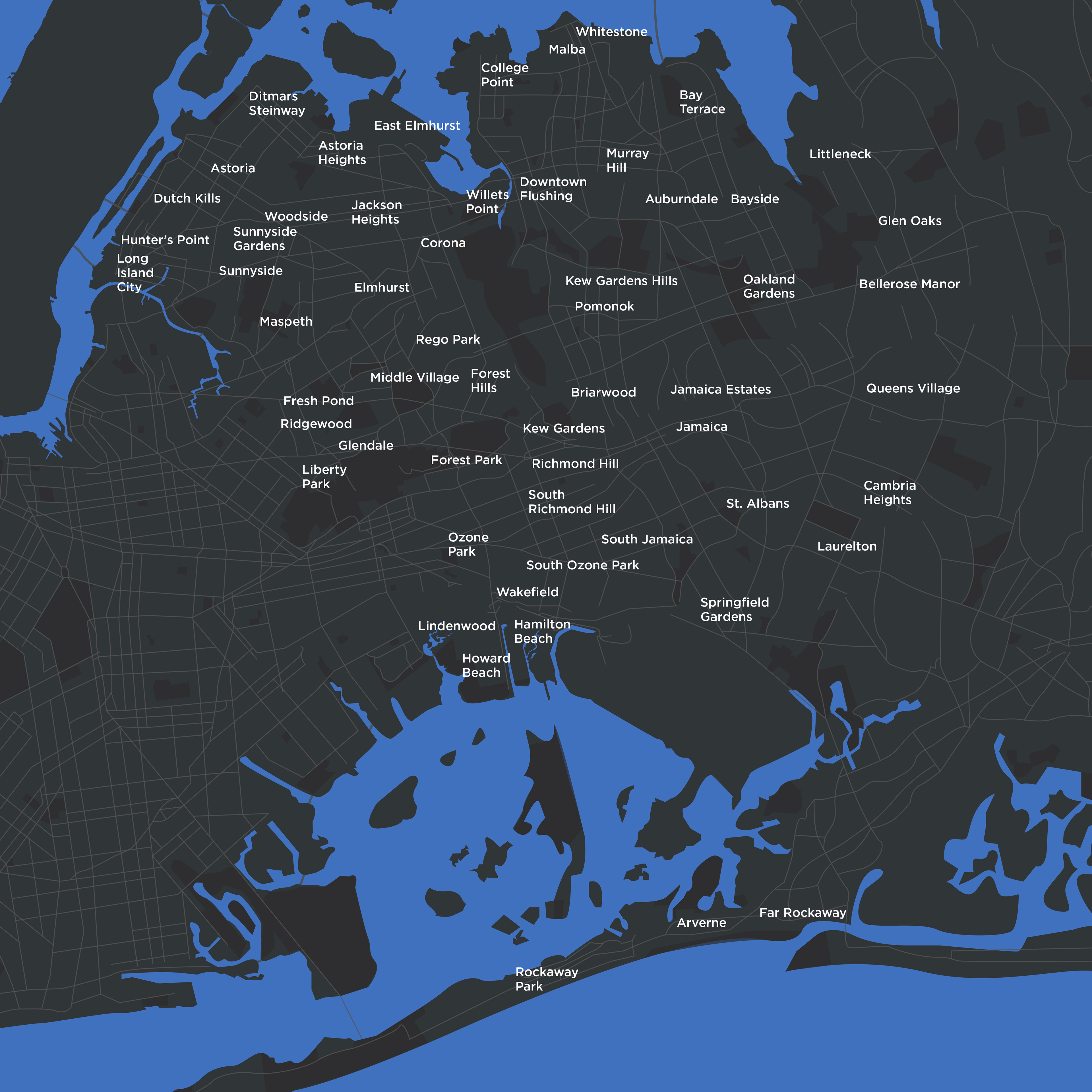
Queens, 2020
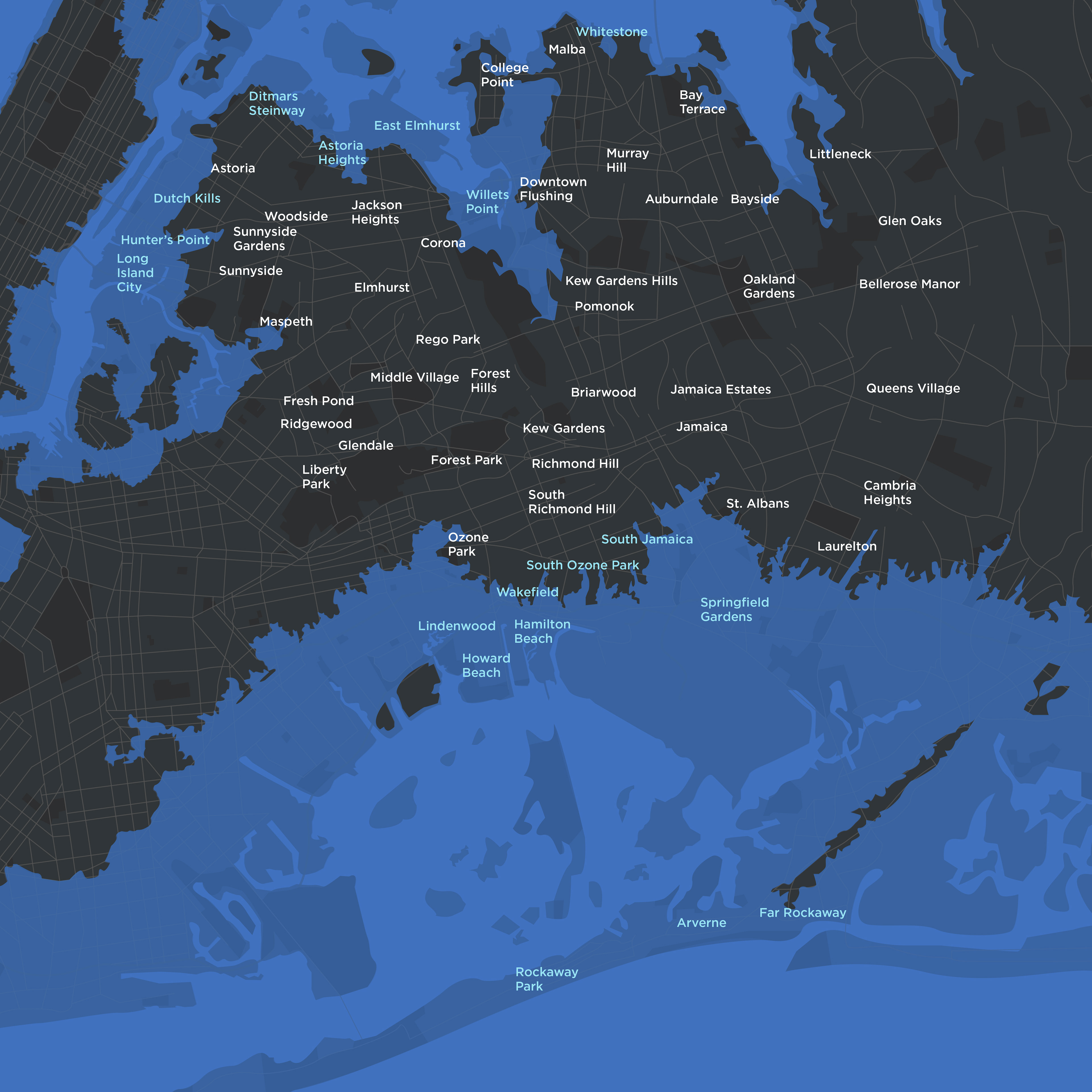
Queens, 2060
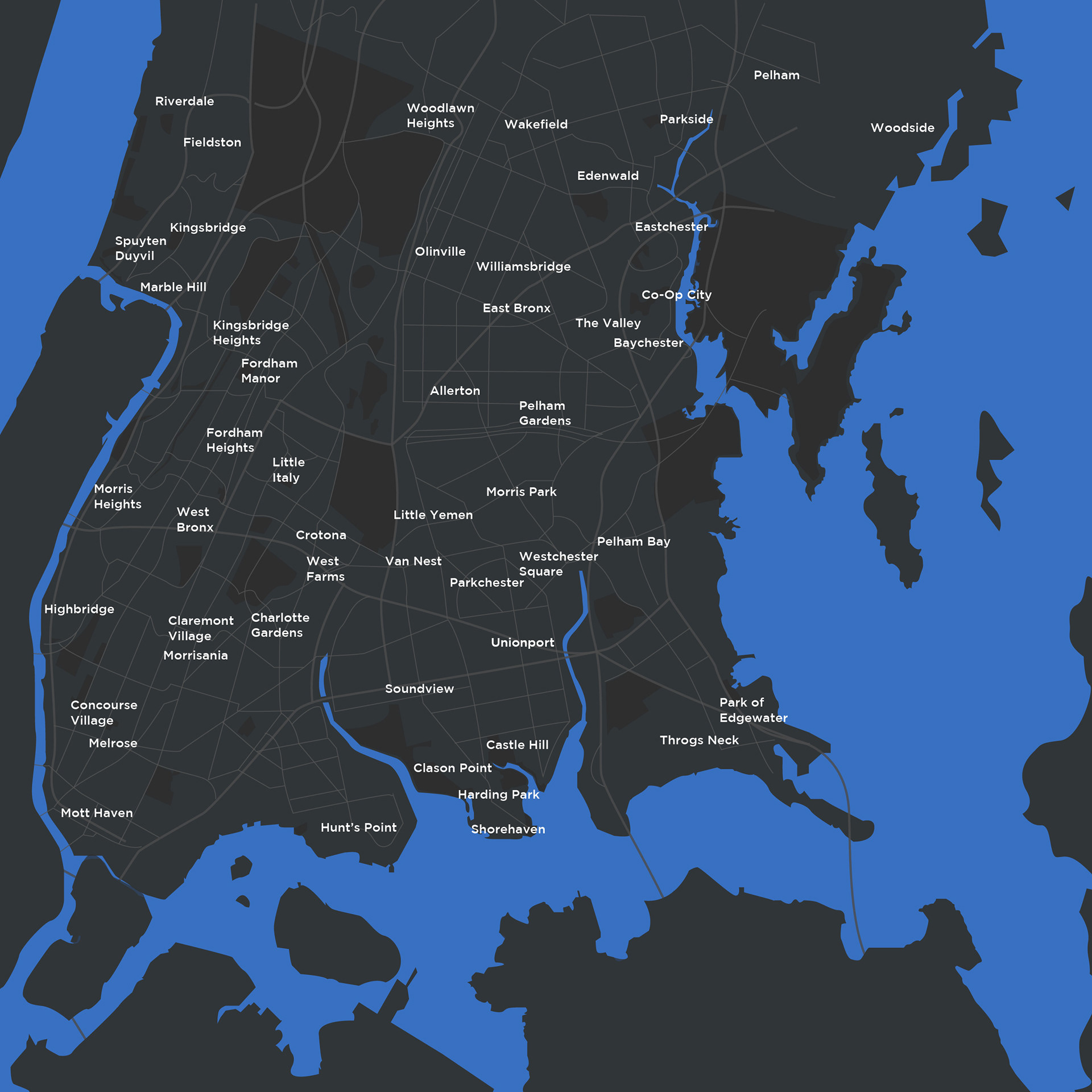
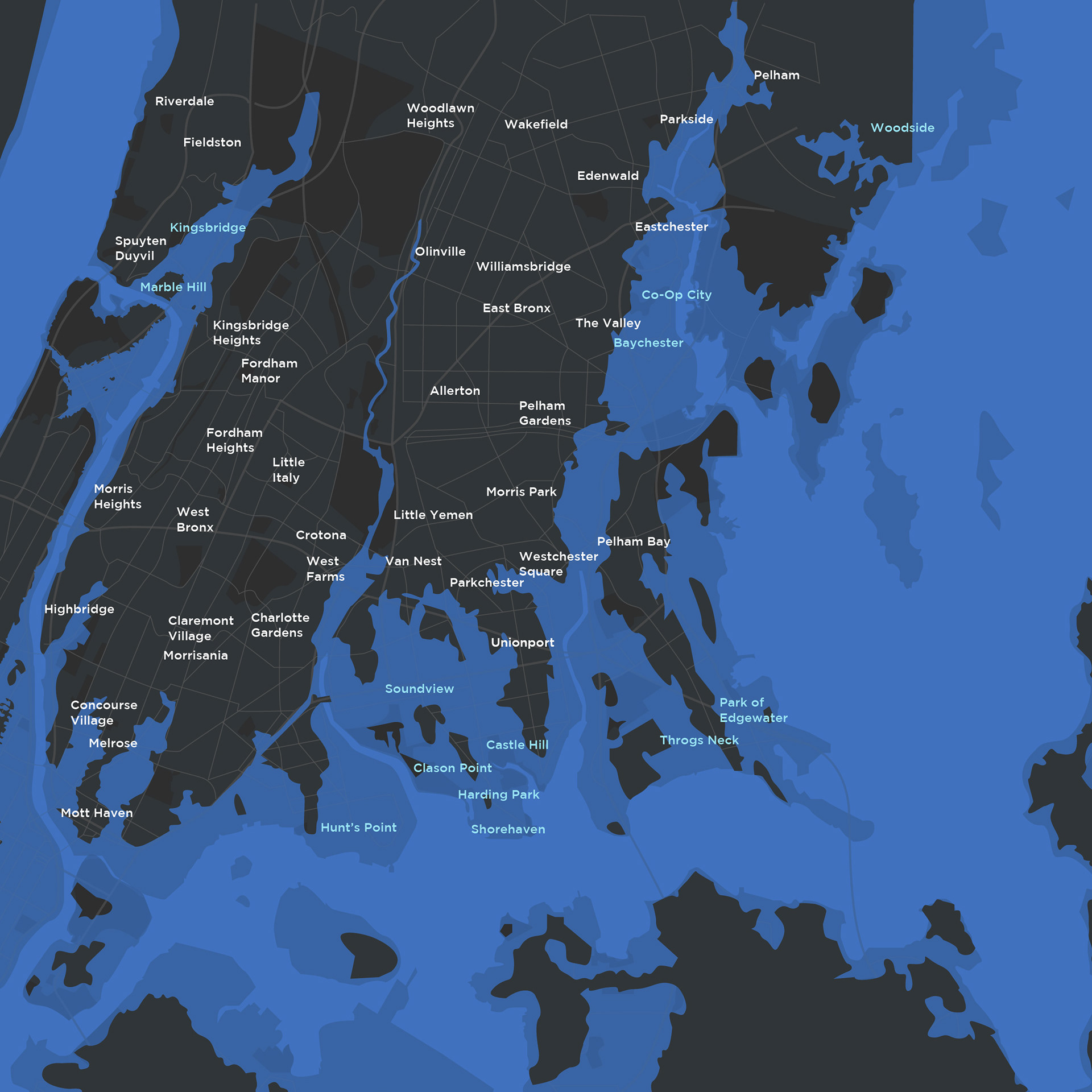
The Bronx, 2020